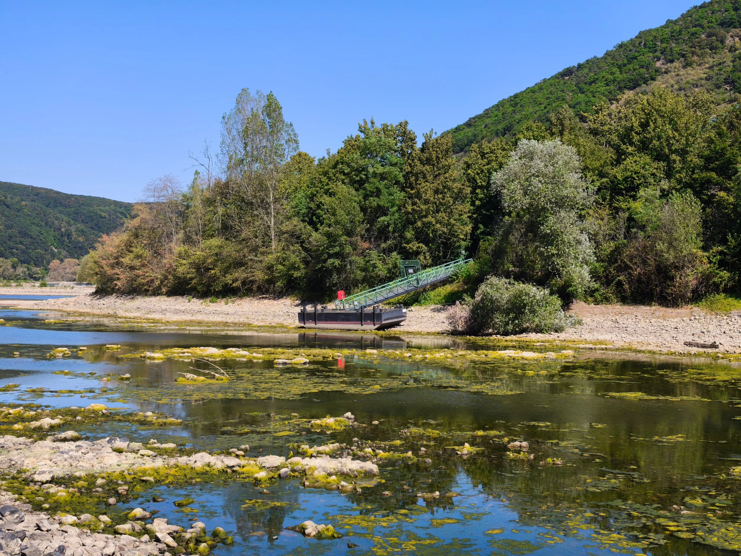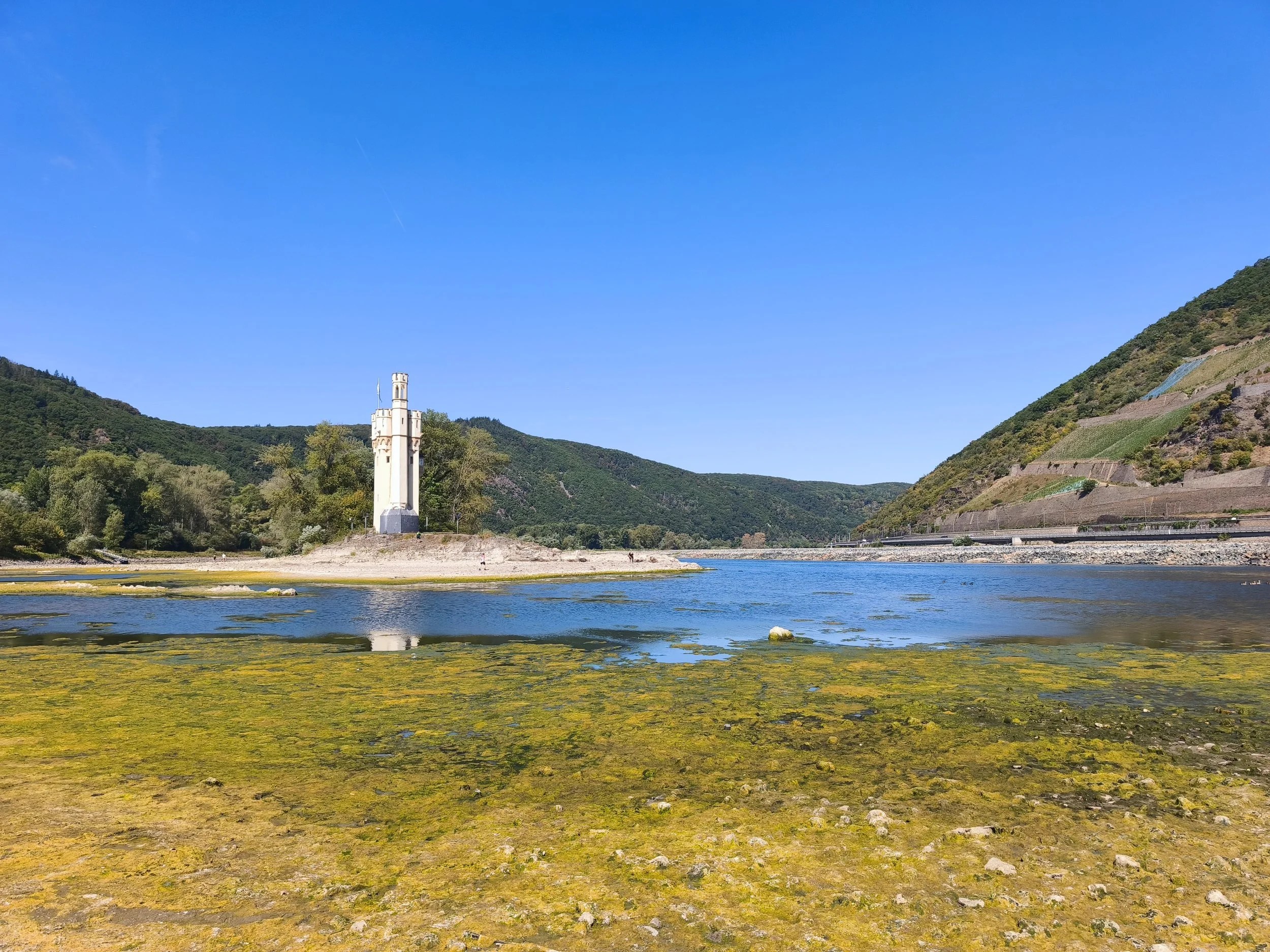
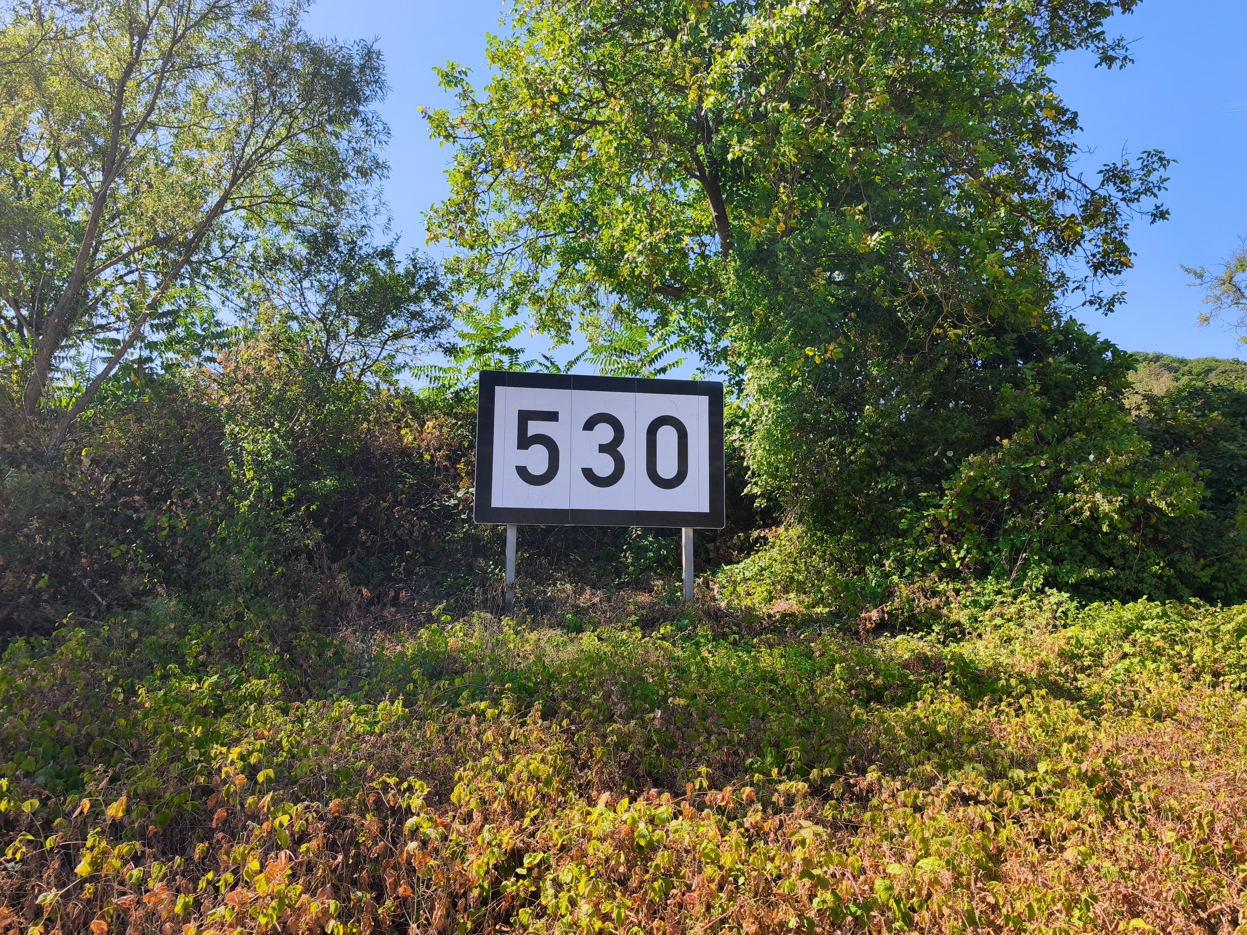
No ships can pass. When you drive down to the entrance of the Upper Middle Rhine Valley you see a very abnormal scene at Rhine kilometre 530.The “Mäuseturminsel” is not an island any more. You can walk over. Around the tower, where the current should be pressing hard against the quartzite, there is gravel, mud, dried algae and the smell of a river that has withdrawn. The Nahe River comes in behind you as a trickle. Castle Ehrenfels sits up on the right-hand slope, looking down on something that no longer resembles the Rhine.
Down here we have the Hungersteine, the hunger stones: boulders in the river bed that historically appeared only in the driest years, and whose appearance was read as the announcement of famine. Now there is not even water around them any more. They are not emerging from the river. They are lying in a dry landscape, as if the river had been an idea someone once had about this valley.
The reference gauge for the whole system is Kaub, at Rhine kilometre 546, a village just downstream of the Loreley. When I queried the live measurement network of the German Federal Waterways and Shipping Administration this afternoon, Kaub stood at 14 centimetres. The mean water level here is 208 cm for 2010–2020, a mean low water of 65 cm, a reference low water (GlW) of 77 cm, and a lowest known water level of 25 cm, recorded on 22 October 2018. The record is now beaten by eleven centimetres — by nearly half. For comparison, the 2003 drought bottomed out at 35 cm and August 2022 at around 32 cm. The forecast for coming Friday is 4cm! One clarification, because the debate constantly confuses the two: a gauge reading is not a river depth but a height above a fixed local datum. At Kaub, 16 cm on the gauge corresponds to a computed fairway depth of about 129 cm. That is why ships are still moving at 14 cm - but nearly empty.
At Rhine kilometre 530, a reef of Taunusquarzit crosses the river: the Binger Riff, through which the Binger Loch was blasted. The rock is extraordinarily hard, which is why it produces the greatest relief in the entire Rhenish Massif, the Franzosenkopf standing more than 500 metres above the water. Upstream of the reef the Rhine behaves like a lake. From the reef the down the whole gorge until St. Goar the flow velocity doubles.
Human intervention here reads like a chronicle of industrial ambition. Before gunpowder, ships were unloaded and warped through by rope from the bank. The first blasting came in the 17th century; a channel not quite seven metres wide in 1830–1832 under the Prussian engineer Ferdinand van den Bergh; widening to some 14 metres in 1839–1841; the old Binger Loch to 30 metres in 1893–1894; and finally to 120 metres in 1966–1974. Works after 1961 reduced the drop at the reef from 80 to 40 centimetres over 300 metres. Before all of this, the reef was in all probability impassable at low water. Boatmen took off their hats and prayed; the church historian Christoph Nebgen speaks of a distinct Schifferfrömmigkeit. Zedler's Universallexikon of 1742 described "gewaltige Wellen" and a "fürchterliches Geräusche", and the 16th-century traveller Andreas Ryff called the place a Schlund, a maw - legend holding that whatever the Binger Loch swallowed was spat out again at the Loreley.
The Mäuseturm was built around 1300 as an additional watchtower in mid-river and appears in the toll records in 1298. Its name has nothing to do with mice: it comes from Middle High German musen, to watch, to lie in wait. The legend of Bishop Hatto devoured by mice is a 16th-century invention. Destroyed in the Thirty Years' War, the tower was restored in the 19th century to plans by the Cologne cathedral architect Ernst Friedrich Zwirner and then served as a signal tower for shipping — until the 1970s its masts regulated traffic through the narrows, and the Binger pilots rode with the vessels down to St. Goar. The Loreley is a 132-metre slate cliff at kilometre 555, at the narrowest and deepest point of the navigable Rhine between Basel and Rotterdam: the bed squeezed from 300 to 145 metres at the Betteck, and 160 metres wide at the rock itself. The danger was never the maiden with the golden comb. It was the Grünsgrund sandbank, with water pouring over rock ribs lying across the river on one side and flowing calmly on the other, the two currents meeting behind the bank and generating whirlpools that killed skippers with regularity.
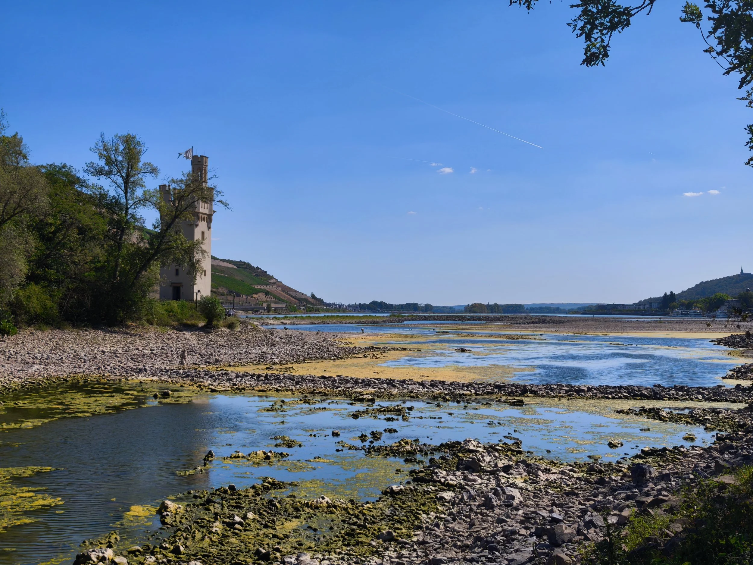
The economic effect of these low water is tremendous, because commercial shipping can no longer carry goods through the region, and the Rhine is therefore no longer continuously navigable and effectively split in two. Traffic continues from Amsterdam, Rotterdam and Antwerp into the northern German Rhine and the West German canal network, and separately in the south on Main, Moselle, Neckar and the Main-Danube Canal.
BASF is the sharpest way to see the structural problem. Ludwigshafen is the largest integrated chemical site in the world, and around 40 per cent of goods at the site move by ship. It sits at kilometre 425, upstream of the narrows; Rotterdam sits downstream. BASF is separated from the northern German industrial heartland and from the ARA ports by a rock barrier with insufficient water over it, and no viable land-side substitute at the necessary volume. The company is deploying more purpose-built low-water vessels and supporting key raw material supply by truck and rail, while acknowledging bottlenecks in individual cases. The pattern repeats along the corridor. Thyssenkrupp Steel Europe has suspended its own push-boat operations, chartered shallow-draft vessels and throttled blast furnace production as a precaution. Evonik at Marl is reducing transport volumes; Lanxess in Cologne can no longer reach certain loading points; Covestro reports effects at particular sites and Shell is diverting to rail, road and pipelines.
The Rhine is not a rain-fed river in the way the Elbe is. Its summer regime has always been carried by the Alps - by snowmelt, and in the hottest weeks by glacier melt. That buffer has historically kept the Middle Rhine navigable through August and September, and it is disappearing. And the ice is going. Alpine glaciers have lost more than half their volume since 1850; Swiss glaciers shed about a fifth of their volume in the decade after 2008 alone. The Rhine is loosing its hydrological buffer. Only about one third of the 2017 volume will remain at the end of this century; without it, roughly 5 per cent, confined to high altitudes. In dry summer months the Rhine level is already reckoned to fall by up to 30 centimetres for want of glacier water.
I have spent enough of my life around weather, water and logistics to know that single events prove nothing. But this is an event which is in synch with many other observations and clearly is reflected in geoscientific data. This river has been drained for centuries. After blasting and narrowing the riverbed, I could imagine there maybe a dam necessary one day to keep it navigable. There are many such examples in China and even at the Nile. That’s going to be interesting. Germans can’t even build a railway station on time and on budget. A dam like this would stretch it.