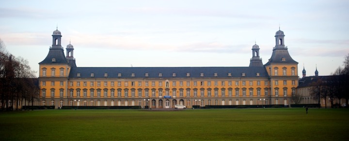
"Draussen nur Kännchen" - in Bonn (Germany)

The first book of Price Asfa-Wossen Asserate, an Ethiopian Prince living in Germany, I read, is called “Manieren” (Manners) and it contains the sharpest views on Germans I have ever read. Not that it would be cynical or unfair. It is just the perspective of an Ethiopian, who sees Germany as his home but from his own viewpoint and by this is a very interesting mirror. Now he wrote another Book titled “Draussen nur Kaennchen” and just reading this title I already bursted laughing. It is one of these idioms which is really untranslatable in any other language (I don’t even try) but hits right in the centre.

I spent some time in Bonn, working right in the middle beside the University, and staying with friends on the Rosenburg. The office was right over one of the large bookshops and coming from Hong Kong, it felt good to see that people are still interested and reading and that the bookshop does not just have a place in the centre of the city, but also in the centre of their life. There are nice coffee houses around, where people meet or just drop by to read the first few pages of their new book. Still many small old stores exist. I bought an old style shaving knife in a shop which still offers sharpening services. And further on I got two pair of hand made Budapest shoes. The staff in there knows everything about their products, greet you with a “Guten Tag”, and advise you on your purchase, but also just chat with you on your interest. 

Bonn was made capital of Germany after the War as it was a neutral ground to be the centre of the new Federal Republic, even it is geographically very far West. After the re-unification in 1989, the capital was moved back to Berlin. Many were afraid at that time that Bonn would go down, but installation and strengthening of European functions, research institutions and also companies have kept the city going. It is a bit like a village with the cultural program of a capital. And in my view it combines the advantages of both. Of course it is less colorful than back in the times when foreign diplomats were on the streets. But it is still a rather civilized city with much to see. 

Cambodia, The Churning of the Sea of Milk

In very ancient times the gods gathered to find a way to receive ambrosia, which would make them immortal like Brahma, Vishnu and Shiva. The jar holding ambrosia lay on the bottom of the ocean and to obtain it Vishnu advised: “Call the demons to your aid and churn the ocean ...”. The gods tried to churn the sea with Mount Mandra, but despite all efforts they could not move the mountain. To unmount it Vishnu called for Vasuki, the king of snakes and it coiled itself around the mountain and unrooted it. The gods rolled the mountain to the shore of the ocean and placed the weight on the tortoise king, who walked into the sea. Then the daemons and gods, holding Vasuki like a rope, pulled him forward and backward to churn the waters. Vapour coming from the mouth of the snake condensed rising to the sky and rain fell to refresh the gods. A lot of foam and spray arised from the churned sea and with it Apsara dancers which are dancing to the music played by their husbands, the gods. This is the legend Samudra Manthanam, or the churning of the sea of milk.

The temples of Angkor and all over Cambodia are covered with endless artworks on this myth. They remind of the amazing high Khmer culture at a time when Europe was in its dark age. But today Cambodia is also just in the stage of waking up from more recent nightmares, of which for example the battles between Cambodian and Thai troops over the Temple of Preah Vihear (N14°23.392’, E104°40.809’) just are a few weeks back. Still today in the remote Cambodian North, troops hold posts on the roadsides with mounted Type 67 machine guns, in beach sandals and without sandbags or any cover and sometimes with a can of Angkor Beer to cheer themselves up until the next clash at this unresolved border line which dates back to the French Indochine.

Since the Independence from France in 1953 Cambodia had a history of turmoil, inconsistent leadership, a main military coup in 1970 and the attempt of the King to overthrow the US backed Military government by offsetting a civil war, which was soon used by the Khmer Rouge Rebels. The intensive bombing of the North East of Cambodia by the US Seventh Air Force to disrupt the Viet Cong turned the region into a crater landscape till today and at the time is said to be driving up the support of the rural population joining the Khmer Rouge. Around two million Cambodians fled the fighting into Phnom Penh, which fell to the Khmer Rouge in 1975. The regime, lead by Pol Pot, announced the country to be “Democratic Kampuchea” and attempted by tyrannic means to revert Cambodia into a 11th century rural state. One Million out of an 8 Million population died of famine, disease and mass executions. Any form of education, intellectualism and cultural heritage was fought my all means. The interrogation prison S-21 in Phnom Penh reminds of this, and is besides German Concentration camps one of the most deeply depressing memorials I have ever seen. In 1978 Vietnamese troops invaded and attempted to end the Khmer Rouge Regime, but could not gain control over the whole territory. Until 1993 the Khmer Rouge were able to hold territories in the North and the South of Cambodia, devastating the land with anti-personnel mines and crippling in the later stages mainly farmers and playing children. The mine fields are up to today one of the major obstacles of development in some regions and are de-mined with international funding at a cost of 2 US$ per square meter. Despite a military coup in 1997 Cambodia is now relatively stable. Only very few former Khmer Rouge commanders have seen justice, to satisfy the demands of the countries providing financial aid. The cases are uncounted, in which people re-visit their past tyrants and take revenge into their own hand, many with a gun.

Today, Cambodia is growing at a very fast rate, specially the black segment of the economy. The government is corrupted, holding its own people hostage to receive foreign aid. The situation escalated briefly when law students recently protested that they have to bribe the judges to buy their jobs in the legal system. The police and the army deforested and degraded most of the forests in the North of the country and exported the wood. Military commanders run businesses all over the country, using their soldiers as free labour in anything from “import/export”, mining operations, logistics down to just shutting off a beach and collecting what is here called “tax”. It seems very obvious that a self-funded army is dangerous in such a country, but even the UN presence can only regulate this step by step. The police and the courts are selling justice to the highest bid and anything implemented by a government body is not an implementation of a rule, but just a “pain in the ass”. NGOs even have to pay off people when they bring their own money to build a school. Sometimes, the ones lining their pockets like this, later re-appear in the opening ceremony and are the ones giving the speech “donating” the school to the people in all pomp and glory. In the South of Cambodia also Russian “Investors” cherish the beauty of the seaside as well as the loose control of the origin of their funds and re-furbish the faded charm of the formerly French settlements in and around Sinaoukville with a “supply chain” that sometimes reaches back into human trafficking. 

Besides all, tourism is picking up in Cambodia as a very important industry. And the most important and most visited sites are of course the temples belonging to the Angkor complex, which is classified as World Cultural Heritage by UNESCO. The closest city is Siem Reap which developed since 1993 from a small village on the river to a nice and open city, which even has an own international airport.

Angkor (map here Map-AngkorMain.jpg) was first visited by the Portuguese Monk Antonio de Magdalena in 1586, but became popular mainly by the travel notes of the explorer Henri Mouhot who was supported by The Royal Geographical Society. In the centre of the Angkor complex, stands Angkor Wat (N13°24.784’, E103°51.850’, download plan of the inner structure here Angkor Wat Plan.png), which was built under King Suryavarman II in the 12th century as a temple and today’s largest religious building. Recent research by the University of Sydney shows that Angkor Wat was the centre of a large urban area which was the capital of the Khmer civilization (download article here: New Scientist 2010 Young.pdf). Angkor Wat is the best preserved temple and attracts a lot of visitors. However, I found the temple not the most impressive, perhaps because of too high expectations. 


A temple which is grown in my jungle is Ta Prohm (N13°26.009’, E103°53.712’, download map here map-ta-prohm-1.gif). South-East of Ta Prohm lies the very impressive complex of Banteay Kdei  (N13°25.786’, E103°51.546) which is built in the 12th century, decorated with Garudas and the four faces of  Avalokiteshvara. Beside you find the large former capital Angkor Thom with the decorated gates with faces. Form here it is easy also to pass Baphuon (N13°26.627’, E103°51.484’), Bayon (N13°26.475’, E103°51.484’), Kleang and the Terrasse of the Leper King, Terrasse of Elephants and Pimeanakas (all around N13°26.752, E103°51.508). The Hindu temple Pre Reep (N13°26.098’, E103°26.098’) is very different from the other mainly Buddhist structures: it is not built in a sandstone covered Laterite, but in red bricks and also follows a different geometry. On the geographically same side are East Mebon (N13°26.798’, E103°55.263’), Ta Som (N13°27.872’, E103°54.710’). 36 km NNE of Siem Reap lies the mainly in Laterite built Benteay Srei (13°35.930’, E103°57.881’), together with Lokei, and Bakong (13°20.115’, E103°58.553’) and Beng Mualia, Kohker (13°47.033’, E104°32.443’) surrounded by a large a number of Linga Temples.

I found Cambodia and amazingly interesting and divers country. And given that the current development only started around 20 years ago, it is another example how a country can be dragged out of poverty in a very short time. Sure, Cambodia is still poor. But if the corrupted government holds or even improves or changes to a better one, then Cambodia has for sure a good future. If not, then not.  

Happy Mid Autumn Festival

The Mid Autumn Festival is celebrated on the day of the full moon close to the astronomical Autumnal Equinox (September 23rd in Gregorian Calendar), which is the day of equal day and night length. The celebration exactly takes place on the 15th day of the 8th lunar month.  Roughly the traditional Chinese Calendar is a hybrid between the lunar and the solar calendar. There are 12 lunar months starting at dark moon at 11 pm. To correct the gap to the solar phenomena (which is important for agriculture, for example), every second or third year has an intercalary lunar month, so that the sun always enters Capricorn in month 11. 

The Mid Autumn Festival is a harvest festival and related to the Chinese myth on Houyi (后羿) and Chang’e. People celebrate with lanterns and exchange (a lot!) of Mooncakes, which are usually very sweet cakes holding an egg yolk in its inner. Last year, I enjoyed very much going to the Hung Sing Ye Beach which was covered with thousands of lanterns, by the families sitting together in the sand. This year I was unfortunately struggling with some food poisoning and missed, while I dropped in bed early. But at least the full moon was shining bright in my window. This was my last Moon Festival in China.

Asia’s World City: Shanghai

In the months before you make a move, you start doing things the last time. The first such “last time” for me now was bringing MBA students on a field tour to Shanghai. I did this for 4 years regularly and the course, which is called “Doing Business in China” (DBC), is a combination of lectures and a field study. It became a very popular elective for MBAs and its abbreviation DBC was recently rephrased by students to “Drinking Beer in China”. Well, this indicates that business relations here are sometimes sealed with the extensive consumption of cheerful beverages, and alumni relations for sure as well.

I enjoyed teaching this course, and also the challenges on the road - specially as we try to also explore things off the beaten tracks. But I also think it is coming somehow to the end of the life cycle in the current format. Shanghai changed and developed so much in recent years, that it does not serve to represent “Doing Business in China” any more, but better “Doing Business in Shanghai”. If I had to re-design the course, I would probably change the destination of the trip to Changchun, Harbin or Chengdu. Shanghai has become international business city, which is outstanding in China, but not representative for its economy and business environment.

And being outstanding, Shanghai does not just in terms of economic development. When I moved there in 2003, I would for example never have imagined that the city would be able to develop an autochtone cultural life in less than two generations. But it happened in only 8 years. It is not yet very sophisticated, but attracts a lot of talent from all over China and abroad. One of the districts where arts and creative industries are settling is the region along the Suzhou Creek. For example 50 Moganshan Lu is situated close to the Suzhou river in Shanghai and is one of the former industrial compounds, where factory halls and warehouses were converted into galleries and studios. The site is now named the “M50 Creative Park”. One of the first galleries you see, is also one of the best: 99 Degrees Art Centre (www.99dac.com), which currently holds and exhibition of the painters Gerard Altmann, Igor Bitman and the sculpturist Livio Benedetti. Also the Fine Arts College of Shanghai University has an exhibition space in the compound, which is an interesting showcase. Then there are other outstanding developments like the converted former Slaughterhouse 1933, the Red City or the restored Jing’an Villas at 2015 Nanjing Xi Lu, which develop all kinds of activities in a traditional Shanghai environment without a massive masterplan.

I also thought in the past that the Pudong skyline is a bit artificial and does not fit into the contrast of the Bund on the other side of the Huangpu river. But specially with what happened behind the Bund in terms of refurbishment and rebuilding, suddenly there are axis of views where even a structure like the Pearl Tower fits into the picture, a bit like the Eiffel Tower in Paris. Another thing which struck me, was when I had a look at the Subway map of Shanghai and the first thought shooting though my mind was: “Wow, how did they do that in such a short time?” Then I looked at it for a while and my last thought still was: “Wow, how did they do that in such a short time?”. The list of things which impress me in Shanghai is very long, and last but not least, it is that Shanghai really recovers its elegant flair which reminds of the old Shanghai in modern times. 

Last but not least, the term “Field Trip” is really not appropriate any more when coming to Shanghai, which I would say really deserves the claim of being Asia’s World City. 

Mount Rinjani (3726 m), Indonesia

Mount Rinjani (S 08 Deg. 25.000’, E 116 Deg. 28.000’) is an active volcano on the Indonesian island Lombok. It is a massive Caldera structure with a new volcano, the Gunung Barujari, inside the Caldera. The crater lake Segara Anak lies at about 2000 m. The most recent eruptions were on May 22nd and 23rd following earthquakes and ash clouds reaching up to 5000 meters. A major series of eruption dates back to 1994/95. Historical eruptions date back only to 1847, due to the remoteness of the region.

You can approach Mount Rinjani setting off at Senbawulun (S 08 Deg 21.481’, E 116 Deg. 31.275’) at about 1200 m. The first half of the day leads through savanna until the pine mountain forests are reached. After passing the clouds a good base camp site is on the caldera rim at 2700 m (S 08 Deg. 23.599’, E 116 Deg. 26.430’). To get to the Mount Rinjani Summit from here needs about 4 hours. For seeing the sunrise (now 6:34 am) it needs starting at 2:30 am. Even in moonlight (moon setting now at 3:51 am) it is hard to spot walkable trails and the first hour goes through loose rubble. The last 300 meters are ascending through loose volcano ashes which is constantly sliding backward. Passing this is extremely exhausting. The view from the summit at sunrise is tremendous: on one side the sunrise over the island of Lombok, the three Gili Islands and the Lava landscape - on the other the caldera with the intense blue lake and the smoking Gunung Barujari.

Returning to the base camp then is more about sliding down in the ashes than walking. From here, there is a steep trail down the inner side of the crater leading to the lake Segara Anak. The solid rocks are a welcome change to the ashes and rubble from the morning hike to the summit. In the crater are hot springs, which are also a treat and there is a local belief that they treat all kinds of sicknesses. For me they relieved me from the fact of not having a shower for 3 days, climbing and hiking since 2:30 am and being 5 kg too heavy.

The Gunung Barujari sometimes rumbles and then clouds are expelled. Hindus come to the lake and put a life cow on a bamboo raft which they push out to the lake. After a while the raft sinks and the cow, which is tied to it, drowns alive. This explains that there are here and there beef bones in the shallow shore water of the lake.

The climb out of the crater on the other side is steep and needs careful steps. An Italian woman died here a few weeks ago. The view back into the crater is amazing again and when reaching the rim at 2500 m you have a full view of the volcano, the caldera and the summit. Descending from here you enter a rainforest from about 2100 m, which is full of grey monkeys. Best is too keep moving until exiting it again, because there are leaches. At 800 m (S 08 Deg. 18.283’, E 116 Deg. 24.053’) you reach Senaru which is a good camp site. 

The island of Lombok will next year get an international airport. Currently there is only a local hub. The connection to Denpasar on Bali is flown on brilliant planes like the Fokker 50. When flights are cancelled, there is a ferry connection which takes 5 hours and also a fast boat in the mornings which makes it in 2 hours. The ferry services are unreliable and usually depart late to give thieves a chance to jump on the boat, steal something and jump off again. Engines sometimes catch fire, which at least delays the journey. If you happen to arrive with a ferry at night, be aware that all transportation (and the prices) are controlled by a few mafiosi in black leather jackets. Keep your knife open in the pocket, but try to stay in safe margins, because the situation is complex and people are skillful, numerous and know the local situation better. 

Tibet - The Roof of the World

The Himalayas range from alluvial North India, via Nepal, Bhutan until the Tibetan Plateau in China. Last year’s approach from Nepal was already very impressive, but this year (not looking for a hard core alpine adventure) the Tibetan side offered an enormous variety of nature and culture. Tibet is a Chinese Autonomous Region and currently needs for non-Chinese nationals a special permit to enter. Another special permit from the Military Authority is required to enter the region around Nyingchi, which is just a few kilometers North of the line of a disputed territory between India and China. The flight from Chengdu to Nyingchi opens a breathtaking view on the Eastern Himalaya and leads through the mountain peaks and descents into a steep landing. In our case, the landing was interrupted due to sudden low visibility, landing gear was pulled back in and the pilot pulled up steeply over the mountains to return to Chengdu, refuel and try again a few hours later. The pilot was finally proud to land safely on the small runway which only 10 pilots are licensed to approach here. Better see it late than never. The “Friendship highway” crosses Nyingchi and driving East leads to Bomi, which is mainly a garrison that played an important role in the "liberation" (invasion) of Tibet by Chinese troops in 1959, "freeing" Tibetans from a "medieval religious feudal system headed by the 14th Dalai Lama". This move is often seen critical, but also it sometimes is forgotten that the latest large scale massacre in Tibet was actually commanded by the British Lieutenant Colonel Francis Younghusband, who entered Tibet in 1904 based on the wrong intelligence information that the Russians would use Tibet as a base to move further South and threaten the Nepalese and Indian territories of the Empire. Bomi is a well located hub traveling further East, where the road becomes a small trail at the mountain side with up to 2000 metres above and 1000 below. Boulders are constantly falling even at this time of the year, which makes it not recommendable to pass during monsoon season in a passenger vehicle. If not a military truck, which was in a convoy to deliver food and equipment into the earthquake struck region in the North, would have blocked us, we would have also been hit by a land slide, which like this just came down a few tens of metres in front. It is an enormous effort to keep this section of the track open, which is a vital connection into Tibet.

East Tibet looks a bit like a very wild Switzerland in terms of landscape and vegetation. I even saw wild strawberries on the way to Midui Glacier, which access was cut off first by a land slide and a bulldozer was digging the track open. The glacier is fed from a peak elevation of 6385 metres and has impressive rings or terminal morains from different stages of development with a lake at 2900 metres. Further following the “Friendship highway” to the East leads to Rawok lake, which was unfortunately covered in snow and did not open up for a view on the scenery.

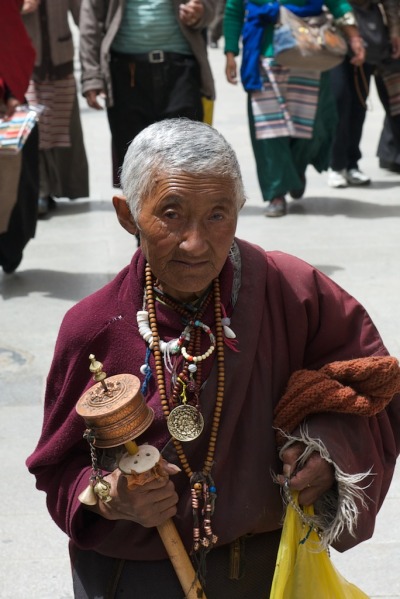
From Nyingchi, following the Friendship Highway to the West is far less dramatic in terms of driving (still the right back leaf spring broke and had to be exchanged), but offers an enormous entry into a completely different landscape. On the way to Lhasa the tree line is crossed at around 3200 metres, going through wide valleys utilized for herding jaks, horses, goats and donkeys or dry farming barley, sometimes with simple irrigation.  Also on the way are thousands of pilgrims to Lhasa, which make their way logistically inefficient but perhaps spiritually enriching by measuring the way dropping their body lengths to the ground moving slowly forward. They are covered by wooden protectors and thick clothes, doing this at least 100 000 times to improve their Karma. Some of them come about 800 km away, and a few even further. Entering the small tent camps is invited and they are very friendly and warm hearted people, some of them speaking Putonghua. 

Lhasa itself is impressive. Johkang temple for example is fascinating in terms of architecture, but also because it is a religious active temple. The Potala Palace is also impressive, but feels more like a museum, as it has only very limited activities. 

Unfortunately, during the Cultural Revolution Tibet suffered over-proportional high from the destruction of cultural heritage, because it was so rich in it. The Cultural Revolution was a man made disaster for all of China and its people and Tibet was struck badly by the power play of  Chairman Mao Zhedong. It seems one of the large dissonances of modern China, that Chairman Mao’s statues are still overlooking city squares, University campuses (which he closed) and cemeteries (which he filled so richly). But it also seems hard to abolish these memorials. Opposite the Potala Palace for example stands communist-fascist style memorial as a counterpoint to the palace itself. I guess, even the most concrete brain conservative CCP member sees how tasteless and idiotic this is, specially opposite such a beautiful palace. But tearing it down is also not easy, because this would symbolically play into the hands of the Dalai Lama and his gang and might even be misused by them to cause unrest. Since last year’s riots, the security in Lhasa seems very tight. Police and army are constantly patrolling with fire extinguishers and pump guns to protect shop owners and other citizens from attacks. They are friendly, even run out of the the line sometimes to buy an ice cream or a lottery ticket, but it is clearly not good to mess with them. As an outsider it is very hard to get a picture whether the riots where really political or simple violent attacks based on greed or other reasons. The tendency I heard goes into the direction, that it were politically camouflaged attacks by mob - not even by local Lhasa Tibetans but by Tibetans from Sichuan. But who knows?

The often criticized cultural delusion of Tibet is of course happening. But this seems normal in a country where people not fundamentally restricted in migration these days. Under the former religious leadership the “cultural purity” was preserved by insolation. But looking at the improvements in health, life expectancy, education, medical services, income and many other indicators, it is very clear that the Central Government is not doing a bad job here. But of course all religions pay their “bonus” in the afterlife. This has been the fundamental basis of suppressing people in Europe for about 2000 years. Only the “shepherd” get paid during life time. That’s the game. 

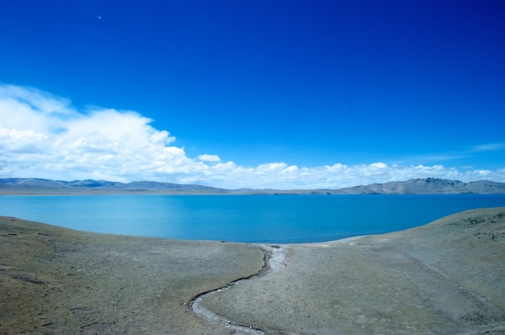
From Lhasa heading to the North lies Namtso Lake - the Heavenly Lake - with an altitude of 4718 metres. It is the world’s highest salt lake and when crossing the pass at about 5100 metres which opens the view on it, the name is instantainiously understood. This lake feels closer to the Universe and above it opens a nearly endless sky. There are some small unheated container huts and tents for rent and while rushing up the mountains to catch a better view, I was reminded by a fever that the air is already quite thin. Barking dogs can hammer quite severely into your brain in this condition and temperatures drop below zero. This is a test for will power and goose down jacket and probably is booked somewhere on the Karma-Account for the afterlife. If not, it is at least a good training for the immune system. Also, the heating and cooking process in the local Restaurant improves immunity: take dried Jak dung and put it on the fire, then cover it with a kettle and take a fresh bread from the exhaust pipe and enjoy. 

One of the most impressive cuts through divers landscapes, reaching from alpine snow, though deserts to green meadows is the 25 hour train ride from Lhasa to Xining. Do not forget your field glasses, because you will spot numerous Tibetan Antilopes (which I did not know, that they exist before).

The city of Xining itself is just shit. But it is bordering the further Western Provinces of China and makes you feel like ramping up gear and supplies again and go further West. But this time, the way had to return to Hong Kong via Xian and Shenzhen. Next time it will not.

Fujian Tulou (China)

From Xiamen it is about a 2-3 hour bus ride to the West of Fujian Province to come to the area of round or rectangular shaped clay buildings which reach back to 14th Century, called Fujian Tulou. The most famous one, is the cluster of dwellings called Chuxi Tulou which is a UNESCO World Heritage site (1113-001). The center rotunda building is called Jiqinglou and is a four storey building from the Ming Dynasty, built in 1419. It is amazing that these constructions are so stable, because the main structure is a 1-6.m meter clay wall. But the round structure seems so stable that even large cracks close again by the pressure. The later built rectangular Tulous are said to be less stable. The inner courtyard of the Tulous mostly has a temple and other central functions, like the well, which serve as a centre point for a whole clan living in such a structure.

The Tulous have been built by Hakka people who migrated from the Yellow River region as a result of civil wars in China. They settled in remote areas in Fujian and the Tulous also had a function of defense against robbers and smaller clans. It seems amazing that the clay walls really were a suitable protection against an attack, but it must have been only smaller conflicts and no serious warfare. Also it seems amazing that the wooden structures inside the Tulous, which are actually the homes of the individual families, only rarely caught fire. It is said, that because the living conditions inside are so dens, a fire will be discovered and put out on the spot. If not, I can imagine being trapped in a round high wall with only one exit, must be quite dangerous. The functions in a Tulou are structured vertically. On the ground floor there is a workshop and kitchen, bedroom on the first floor and sometimes also on the 2nd and then another workshop and storage floor. 

Still today, beside the upcoming tourism, the main economy is based on agriculture and the highest margin crop is tea. What makes the Tulous specially interesting, is that they are not just a form of settlement, but are deeply integrated into the form of life and culture of clans. Of course, these cultures are very enclosed. Even without understanding the spoken word, you can already feel that the people’s character from Tulou to Tulou is different. With the development of tourism, the buildings also become economically attractive again and many families which abandoned the Tulous and live in a township or village, now return and re-claim ownership. Recently this is causing in some clans a lot of conflict. 

Another thing, which surprised me at first, is that there are not just a few of these buildings, but that they are still today a dominant form of settlement spreading over a large region. I hope the tourism here will be developed wisely, to avert possible negative changes, because the Fujian Tulou are really a “World Cultural Heritage” in the true sense of the meaning.

Japan’s Cherry Blossom

The first time I had the chance to see a bit of Japan outside Tokyo and Kobe. The route took me from Nagoya, first into the mountains to Takayama and then via Nagoya to Kyoto and back. Of course this is only a very small region, given the whole variety Japan offers in landscape and culture, but already this sample was stunningly beautiful. First of all arriving in Nagoya, I expected some haze which would have matched the fact that this city is one of the world’s largest industrial production power houses. But instead, I was surprised by crystal clear air and an amazing visibility over the city and the sea. Then a trip to Takayama, was a nice journey through though alpine sites and the city itself is quiet and has a centre of traditional Japanese houses. Then Kyoto has such a rich culture that it is completely impossible to see even only a fraction of it in a day. Japan needs more time, and is very interesting to explore. My first impression is that it is culturally utmost refined. Just the plain number of museums and traditional buildings show that such topics are a central point. People, are very friendly and kind, even though characters seem complex and faces and expressions hard to read (for me). I will for sure return to Japan and learn more.

Macao - washing it white

The Historical Centre of Macao is classified as UNESCO World Heritage since 2005. When reading the UNECO justification for inscription, there is a lot said about Macao’s role in the cultural exchange between China and Portugal and its unique history. Today Macao does not show much of its heritage any more. There are still remains of the old fortress with the Museo de Macao on top, but the small and crowded territory does not leave much space for preservation and the major development focus on the Cotai Strip Casinos and the South of the island also seems to leave no interest for the heritage of the city. Beside the few landmark buildings, most sites in the older part of the city are in bad condition and it seems strange that they are not developed into an attractive little old part of the town with cafes and restaurants. There are good restaurants in Macao, hidden in some side streets. But there is no nice cluster of them, even the potential looks good to upgrade a whole quarter following the Shanghai Xintiandi-Model. Perhaps it is also better that it does not happen now, because many recent attempts to develop places with cultural heritage, simply failed because of any a lack of experience how to proceed. Sometimes with the result that they are lost forever. It might take a few generations first to rebuilt the cultural understanding and technical skills to conserve the city and up to then we can be lucky when nobody spends the money to tear most of it down and turn it into Shopping Malls. Today, it is still a nice stroll around the little streets and also to go down to Coloane, where there can be still found a little bit of fishing village charm and Portuguese past residential grandness. 

The new casino and entertainment developments of Macao are mainly catering into tourists from Mainland China and Hong Kong: big, glamorous and really low taste. The typical luxury brands are all there to catch their cheap clientele which mainly recruits from Chinese new rich and other shady individuals. Not that you imagine anything like 007 class characters. It is more about obese, unwashed creatures that somehow made enough money to fart into luxury hotel pillows. The exchange of culture, praised by UNESCO, has been mainly taken over by the exchange of body liquids with adequate female counterparts. But also here, don’t imagine any “The World of Suzie Wong”-Romance, but more a robust biological process fueled by an extra large glass of Moutai. In case of company outings by Hong Kong bankers celebrating their newest achievements and contributions to the world economy, it is Champaign of course and slightly less agricultural. 


In the photo album on the left you find some recent pictures taken in Macao. It is interesting to see the mix of Chinese and Portuguese, not just in the building remains, but also in the local people and their habits. Even it is fading, there is still some flair of it left. Traditional Macao still feels a bit Iberian to me, even it is so far away and the connections between Macao and Portugal were not as strong as the one between Hong Kong and the United Kingdom. Macao is not Hong Kong in many ways. Only on the North part of Taipa Island you find high rise buildings Hong Kong style. Over most other areas Macao still has a nice skyline. 

For some Hong Kong Tycoons Macao has been a back yard of their businesses for many years. An interesting and well researched  book on how Oligarchy developed in Asia, is Joe Studwell’s “Asian Godfathers - Money and Power in Hong Kong and South East Asia”.

In some corner shops, I even heard some Fado played. Quite a surprise, actually in these noisy corners. 

Sure, the “past glory” of Macao must have been much less glorious than it could look like. Just thinking of the time when the city was a last refuge from  Japanese terror and crowded with starving refugees after the invasion of Hong Kong. And later having nearly no physical buffer to Communist China, but a small river to Zhuhai. Today the two cities seem to be growing together in a similar model as Hong Kong and Shenzhen, just on a smaller scale. Zhuhai is actually a very nice and green place, which is trying to keep up successfully with the South Chinese peer cities, with non-polluting industries.

Island Life

On my flight back to home I re-read Henry David Thoreau’s “Walden” and “On the duty of civil disobedience” which original tile was “Resistance to civil Government”. Thoreau, who lived from 1817-1862, embarked himself on an experiment to live remotely, from the labor of his hands and describes his observations and thoughts in his book, published in 1854. He also wrote widely on natural history, ecology and philosophy, was supporting abolitionism and is sometimes cited as an individual anarchist (which symbol, the circled A, made it recently into the uniformity of the sports wear company Adidas). I am far away from understanding the philosophical thoughts and movements behind this book, simply by having not explored the body of literature around it. However, I read Walden with sympathy, thinking that Thoreau’s experiment in some respects comes close to going on a very early form of what we might call “Sabbatical” today. Not every Sabbatical is equal though, but as mine is a bracket of experiments and also remoteness, I re-read the book with very different eyes than I did in Gymnasium (High School) times.

Living on Lamma Island since more than 3 years now, an outer island of Hong Kong in the South China Sea, is of course not the kind of remoteness Thoreau describes in Walden, but it is a place away from the buzz of what likes to call itself “Asia’s World City - Hong Kong”. The backsides of the island and really rural and in one of the scattered old fisherman’s village houses between a small wild beach and the jungle is a simple base.

When I came in 2007 to come from Shanghai down to Hong Kong, I did not know how long I would stay and the only plan I came with, was to think through my past experience, breed on new ideas, publish and teach. Obviously one way to do that was also to engage in the local Universities, which I did as a Professor at the Hong Kong University of Science and Technology and later at The University of Hong Kong. My move to the latter one was driven by the thought that a more comprehensive University would be a better base to explore interdisciplinary ideas than a mainly technical University and in many aspects this was right. For example, beside being a member of the Faculty of Business and Economics, I taught a course in the Masters in China Development in the Department of Geography, which brought me back to my origins as a geoscientist.

This time and this place gives me the opportunity to try out many things and reflect on many topics. Sure, there will be no book coming out of this, like “Walden”, but looking at some travel book entries about this island, I thought it might be nice to highlight some places and phenomena here, which can usually not be found in guide books. They are “my places”.

The old “Tuberculosis Clinic”: legends rank around an old clinic buildings which are located in the jungle between at the foot of the hill with a remote Barbeque Place (N22 14.042 E114 06.493). It is not easy to reach from the land side, but only a few hundred meters for a swimmer from a small beach bay. When you climb over the entrance gate, you enter a world which stopped perhaps 50 years ago - could me longer, only touched by some squatters who left a few belongings which inspire to think what people they were and which life they had. Some notes are left in Spanish and I was told that a Mexican Woman lived there with children. One building is burned out, others are nicely decorated in recent times. Scrap is tidily piled and sorted. Some books, an old piano, a water pond, old coal cookers and trays like they were used in hospitals. There is just wind, the sound of moving bamboo, some birds, mosquitos and when looking out of the window over the sea you can not help feeling that this is a place still some souls might be who spent or ended their life here.

The morning walk trail: From a small plateau at N22 13.865 E114 06.985 trails enter the most Northern hill side of the the island. It makes a very nice morning walk of 2 hours and covers incredible views on the South China Sea island world, the city of Hong Kong and the Ships passing through the strait. You can watch the pilot ships embarking and debarking from the container vessels to guide though the narrow waters. On the top of the hill Igor, a Russian Short Wave radio amateur, has set up an antenna to morse and talk to the world like in the “old times” when wireless communication still needed some skills and knowledge.

The model plane hill: Walking on unpaved trails from Yung Shue Wan to the South of the island, is a slope which can be seen from far, by the many eagles turing their circles there on sunny days in the thermic. The strong updraft at this point (N22 13.350 E114 07.311) has been also discovered by a group of model glider enthusiasts which are flying their remote controlled planes here sometimes even more acrobatic than the eagles. I like sitting at this place and watching it all, first of all because I was flying model planes myself many years ago and secondly because I enjoy seeing people which are enthusiastic about building and flying these planes. Enthusiasm on building things is very rare in Hong Kong, so this is not just a beautiful, but also a valuable last refuge.

Gerd Heinz Balke’s grave: A few minutes walk South of the model plane hill, there is a graveyard in the bushes. It is not one of the traditional graves, like there are also many on the island, but one of these more compressed ones. I do not know Gerd Heinz Balke who died here in 2000 at the young age of 51, but I was surprised to find a German name. I found that he was a German engineer and the author of the books Paradise fermenting and Skull dance. He lived in Po Wah Yun and the title picture of his book Paradise fermenting, a tattooed dragon, was taken by Bob Davis. I bought the book for my Amazon Kindle and tried to understand and see the world though his eyes. Gravestones are like memorials for small people and sometimes I sit down here and wonder about what possibly brought him here and how he lived - of course not without thinking where I might still go and where the journey might end.

Behind the Lamma Winds: “Lamma Winds” is the name of an experimental wind power plant run by Hong Kong Electric on the island (N22 13.523 E114 07.249). Downhill the way which was formerly used to bring in material for the plant, there is a remote village which faces Aberdeen on the other side of the Lamma Strait. At the entrance of the village is a hand drawn bill board in Japanese nailed against an old tree. It enquires about a Japanese boy who lived in this village and went missing in 1945 and gives a local phone number to call. It looks like somebody is waiting that the man who was this boy, one day will revisit this station of his life and find an old friend. 

The overhanging Rocks: On the Southern part of the Island after crossing over the top of Mount Stenhouse, partly breaking through thorny bushes, there is a granite stone structure where one rock is reaching out, held by another one on it. I sometimes brought student group up there on a weekend hike (the few which can handle a steep slope). The structure itself is amazing and usually after the excitement, they turn quiet sitting there and watching the ships passing by on the glittering sea.

Turtle beach and the ginger flowers: One of the most beautiful beaches here which is accessible from the land side, is on the Southern Side of Mount Stenhouse. Passing trough old villages, an remain of a school building and plains of ginger flowers and gardens you reach this bay. Here sea turtles are breeding and from June until October the access is prohibited to protect the habitat. This unfortunately does not stop some Yachting Hobby Captains to enter into the bay from the water side and even sometimes blast pop-music into the scenery to have what they call “a good time”. But most of the time, outside the protected period, this is a wonderful place to be.

Main Villages: The island is connected to Hong Kong Central and the Aberdeen Port by three rather frequent ferry lines by Piers in the villages Yung Shue Wan, Sok Kwu Wan (N22 12.381 E114 07.871), and Pak Kok (N22 14.195 E114 06.598). The first two of these villages have made it into travel guidebooks and on weekends are flooded with tourists, but Pak Kok still remains a silent refuge. Yung Shue Wan has many small shops for daily supplies, a bakery (N22 13.608 E114 06.680), a post office (N22 13.605 E114 06.635) and a little clinic with nice staff and excellent health services for all the small things which can happen. I avoid this village on weekends, because of the tourists and on weekdays because of the intensive construction works with which the Drainage Department follows its obvious mission to convert the world into a public toilet (which was a good mission is days when there were non). Another reason I avoid Yung Shue Wan is that, even there are no cars allowed, the construction and shop logistics is kept up by village vehicles which are noisy and frequently operated by careless drivers. The only reasons to pass by Yung Shue Wan is ferry access and to get some basic supplies. On the Southern part of the Island, the main village is Sok Kwu Wan (N22 12.381 E114 07.871), which is connected by ferry to Central Hong Kong and by land via a concrete trail to Yung Shue Wan. Sok Kwu Wan is famous for seafood and dominated by a group of restaurants called “Rainbow”, which also operate their own ferries. The food is neither specially good, nor specially cheap, but somehow it became a tourist attraction. Pak Kok Village is still much more remote. Inconvenience in access and getting supplies attracts a certain kind of people, which appreciate quietness and nature. Other villages are scattered over all the island, which have different characters. Many of them are too dense build up to live there, but nice to pass through on a walk.

People: The Island is estimated to have about 3-4 thousand residents, most of them living in the main village clusters. This number seems to vary a lot, as a large number takes it as a hub for some months between other travels. Lamma Island has the reputation of a hippie island, where Cannabis is grown in the herbal garden and all kinds of drugs find their way to the end consumer. Even there is a significant group of now increasingly elderly citizens which can not let go from what they think is the “good old 70s and early 80s”, the island is not a hippie refuge any more. This group of the island community seems for me to have established a “live and let live equilibrium”. In terms of drugs, I guess the only over-proportional consumption of them seems alcohol. But I might be wrong. When blood alcohol level drops to being close to sober in the morning, comes a period of vomiting, usually followed by a round of rock music and then already time is coming for another drink. In the Centre of Yung Shue Wan there are a few bars forming the social centre for the “ever drunks”, but these places are avoidable and I can not even recall their names.

Another group are people who work in Hong Kong and fortunately of all kinds of backgrounds. Increasingly also ethnic Chinese move in and appreciate a bit of village life as a strong contrast to the crowded and over-urban Hong Kong. All over Lamma Island is a colorful place in terms of attitudes and in my eyes a place where diversity works very nicely. The indigenous residents are traditionally mainly fishing people and now run small shops and restaurants, partly as a source of short term supplies for residents and partly targeting at tourists which come into the villages in large crowds on weekends. They work hard and take life a reality. 

Tourists: The tourists coming to Lamma Island usually do not leave the main paths and they are a significant income source for many shop owners, food shops and restaurants which retail along their ways. The main kind of tourists coming are unfortunately very unpleasant people and far too many. Noisy and rude - they stick to their Hong Kong manners, even they face a bit of nature and stay “plugged in”. One disadvantage they speak the local dialect of Guandong Province which is called Cantonese. This language seems originally designed to ensure basic communication by shouting over from Hong Kong Island to Kowloon and it has not adapted to the world of mobile phones (even this technology is quite overused in the region). They shout at each other from distances of 3 feet, like they would have to bridge a mile. Cantonese also seems to be a very colloquial language, which did not develop a significant body of literature or any special vocabulary which is outside the semantic fields of pop-stars and computer games. But I might be wrong, because my Chinese language interest focussed on Putonghua (Mandarin Chinese). Fortunately, the physical dysfunctionality coming from their lifestyles, does not allow them easily to leave the villages or the so-called Family Trail connecting Yung Shue Wan and Sok Kwu Wan. But sometimes they can not be avoided on the ferry.

Artists: Lamma Island is sometimes quoted to be an “artistic environment”. There are a few people around, who found a way of making a living out of some simple handicraft and assignments as a photographer or journalist, designer or writer. There are only very few outstanding examples but also they seem to be stuck in the passage of their life when they were good and missed the developing their skills, thinking and experiences further. Alcohol and a certain concept of rude and careless individualism, which is a mistaken for “freedom”, makes it largely impossible for them to develop further refinement. On the other hand, here is a place, where people receive appreciation for their doings and are happy to be recognized. Where else in the world can a “painting housewife” be a celebrated artist?

Dogs: There are many dogs on the Island, which are mostly companions of non-indigenous residents. The dogs are peaceful and used to people. Only outside the villages, there can be some vicious dogs found. But also those rarely attack. If they, it usually is a result overestimation of abilities and at this point I refer to Korean dog meat recipes. However, I do not   encourage actively hunting dogs for meat, because many island residents have very emotional relationships to their pets here.

Snakes: Legends say that during the Second World War the Japanese were running a snake farm for experimental purposes on Lamma Island. I would not be surprised if this is just a local myth. But as a matter of fact there are many snakes on the island, including very venomous ones like the Chinese Cobra, the Bamboo Viper and even the Banded Krait, which I have all seen here myself. The most surprising one though was a Burmese Python in the bushes behind Mount Stenhouse. 
Luwak Coffee (Bali, Indonesia)

Finding a way to increase the economic margin in rural areas, especially when it comes to agriculture is not easy, and a best practice is BAS Agrotourism, close to Kintamani on Bali (Indonesia): S08 Deg. 22.231”, E 115 Deg. 20.398’.

The farm is specialized on crops like coffee, cacao, ginseng, lemon grass and has the attraction of Luwak Coffee. Luwaks are fed with coffee beans and as they only eat the best ones, their excrement is then roasted to what is claimed the best coffee in the world. And it actually is a very good coffee, even it is not easy to compare directly because of the Indonesian way of brewing it (no perculation, just putting the coffee powder in the cup and let it sediment. The closest way of making coffee like this is using a Bodum pot

BAS also runs an organic shop at prices mainly targeting foreign tourists and the owner also records and markets Balinese music.

“Insel der Daemonen” (Island of Daemons)

Friedrich Da(h)lheim’s movie “Die Insel der Daemonen” (1933) and artists like Walter Spiess shaped the perception of Bali as a mysterious island East of Java and Sumatra. The cultural centre of the island still is Ubud, about one hour’s drive north from Denpasar, where Spiess cultivated an art scene starting from 1927 until shortly before his death in 1942; when a Japanese bomb hit the ship on which he was deported. One of the impressing Centers cherishing Balinese culture and art is the ARMA Museum (S 08 Deg 31.404’, E 115 Deg 15.931’), which is exhibiting all styles of art and keeps customs alive by many cultural events. A very good bookshop with a large section of books on historical and contempoary Indonesian topics is the Ganesha Bookshop, only a few hundred meters along the street from the ARMA Museum to the city centre.

As travel preparation Leonard Luera’s “Ubud is a mood” (2004) is far superior to any conventional travel guide. It is not available on Amazon, but the Ganesha Bookshop offers mail order service too. 

One and a half hours drive further North into the volcanic region close to Kintamani you can stay in the Caldera around the stratovolcano Mount Batur, at the shore of a large lake on the foot of the mountain. The two main villages are Kidisan and Toya Bungkah (S 08 Deg 15.232”, E 115 Deg 024.023’). Both villages are a bit filthy and hostels are simple (but not cheap at first sight). The best view point is not the volcano itself, but to go for the sunrise up to the caldera rim. An excellent point is S 08 Deg 16.061’, E 115 Deg 25.819’. At around 1600 m height, from here you look actually down on Mount Batur, which is 1412 m heigh, and furthermore you see the “Home of the Gods”, which is the 2567 m heigh Mount Agung down the Eastern Caldera flank. The hike through the mountain jungle starting in the early morning from 3 am is a safe tourist repellent and there will be nobody else for sure. A good walk from there is over the rim of the caldera to the Northern tip of Lake Batur from where you can see the volcano reflected in the water. Here you pass above the village Trunyan, which inhabitants are described as “primitive”, due to not  cremate or bury their dead but operate their cemetery like some kind of smelly human compost in a village called Kuban, where the corpses are deteriorating in bamboo cages. The villagers have their fields up the mountains, ask for money, and support their arguments with simple carabiner hunting rifles, caliber .22 hornet. Also this keeps the ordinary tourist away, which makes such incidents not a robbery, but a “service charge”.

The way back South has a very scenic rout, passing Sueter, Pempatan, Menanga, Rendan and then turn left via Mucan, Peringsari, Selat, Duda, Sibetan, Bebandem, Bungaya Kagin and Amlapura. Then follow the coast rout to Denpasar. Avoid Kuta.

Bali is an incredibly interesting place. Really an island of daemons, ceremonies a beautiful nature and a sophisticated art scene. Ideal, not to travel a week, but to stay at least a month after six months reading.

Arma Museum (Ubud)

Shame on me that when I heard about the “ARMA” museum I thought first about Box-Jenkings “Autoregressive Moving Average” (ARMA) which is a stochastic autoregression model to analyze time series. To my surprise I found that the ARMA Museum in Ubud, Bali (Indonesia) analyses time series in a very different way then I expected and the name here stands for Agung Rai Museum of Art, named after the founders of the ARMA foundation Mr. and Mrs. Agung Rai.

The museum is a very impressive mirror of all styles of Balinese Arts and exhibiting the works of I Gusti Nyoman Lempad, Ida Bagus Made as well as in a separate building the fusion of Balinese and foreign arts including Walter Spies. 

ARMA is aiming to be more than just a Museum, in terms of exhibiting great works in a great manner, but also is an active part in practicing balinese cultural heritage, like dance and wood carving. The building has the typical grass thatched roof and opens up large halls inside. And the garden around is a beautiful merger of sculptures and nature.

The entrance ticket includes a Balinese coffee for free and the very nice wardens that show you around, are excited and interested about their museum as if they would have inhaled the mission of spreading the spirit (in the usual Balinese polite way).

This museum convinced me that I need to come back for longer after a lot of reading.

“One child, one desk, one chair”

Yao Shing Xiang  is a Chinese writer from Guizhou Province and he tells how he went very early with his mother on the long walk to the market to sell their vegetable. On one of these days many farmers were offering their crops and prices tumbled and at evening time somebody from a public canteen offered to buy all their vegetables if she can issue a receipt. She asked her son, who was in the first year primary school, but even he tried hard, he could not do it. Then his mother tried again very hard to write her name and the little Shing Xiang watched her turning tearful. Yao Shing Xiang worked very hard starting in a Chinese rural Primary School and decades later became a writer. When he published his first book he went to his mother and pointed to his name on the cover. But his mother could not recognize the characters for his name. This time his eyes filled with tears.(Shenzhen Airlines inflight magazine, 04/09, page 22).

In 2006 Mr. Zeng from the Shanghai Volkswagen Foreign Service Department agreed to convert a part of my generous Volkswagen “Expat package” into a donation for a primary school in one of the poorest regions in China. The money was submitted jointly with my landlord, the Santana Real Estate Company, represented by Mr. Gu via the Chinese “Hope” initiative and used to construct a new building in the “Bing Hui Primary School” in Yiliang County. It is named after General Luo Bing Hui (1897-1946) who became famous in the war against the Japanese invasion. General Luo was born in a village a few hours walk from the school location in Yiliang and his widow in Shanghai organized the support of 100 such schools in 2005/06. Kindly guided, supervised and hosted by the Secretary of the Chinese Communist Youth League of Yiliang County, Mr. Li Fu Chung, and the Deputy Director of the Education Department, Mrs. Yian, I inspected the building and facilities over what we call Easter Holidays and was very impressed by the determination of the local government authorities and staff to achieve the aim of 9 year free education and “one child, one desk, one chair”.

Given the conditions, this is a tremendous battle against the odds. At an average income of 80 US$ per year the workforce of the children is a significant help in the families and it is not easy to enforce the compulsory school law. The main income comes from farming and some children have a three hour walk from their dwellings before they reach school which starts at 8 am. The largest employer is the government and the army, followed by lead and zinc mining operations which discharge directly into the Yiliang River. Some environmental management procedures seem in place, but a site like this is likely to bring in general an economically better, but shorter life. The county government is collecting locally a tax per ton of truck loads at roadside haul truck balances. Also at these road sides, walk black coal miners with small children on their hands, back home after their shifts. They come out of small, mostly illegal, mines hidden in the mountains. As lead and zinc deposits usually coexist with other heavy metals and minerals which are even far more toxic, it is easy to imagine the level of contamination the people are exposed to. It is hard monitor what effect this has on public health and birth defects even more so as many disfigured babies might never see sunlight of their first day. I was told that 80 % of the counties income is from mining and nearly all of it is spent on employment, infrastructure, public services and education.

The “Bing Hui Primary School” is located a few kilometers outside the main settlement at coordinates N27Deg.38.756’, E104Deg.01.846’, 820 mNN and currently provides 251 lively children primary education and food in a very nice environment. It is easy to be moved by all these children strolling around, playing and learning. The building which was newly built with the donation’s money is a very nice and white two floor brick construction with a concrete frame which should withstand a sudden earthquake, like the one in Sichuan, but at least a Magnitude of 6 Richter Scale. The construction was supervised by Mr. Li (Xiao Li) from the Education Department, a very diligent and knowledgeable young man, who knows what he talks about.

Isn’t it stereotypical “German” of me that I talk more about the engineering side of it than about the children? But I don’t know what to say. They are as innocent and smart as any children, I guess. And of course, I am very proud of the school and co-sponsoring it is something really significant. But how will these little lives go on? Some of these boys, perhaps the strong ones, will die in the shafts of an illegal mine. Others, perhaps the clever ones, will turn into members of the local mining mafia or become corrupted funtionairs. Some of the pretty girls will perhaps move to Guangzhou and work in a shady Karaoke Bar. Others will turn old far to early under the weight of their baskets carrying their vegetables to the market. To break the cycle of poverty there is much more to do than getting lost in a romantic little primary school in Yiliang County.

After a strenuous journey back to Hong Kong I read in the news that China is urged by the so-called International Community to play a stronger role in supporting the global financial system in the current economic downturn by its currency reserves. China had many glorious moments over the last years and impressed the world with an enormous economic growth and last but not least with the most spectacular Olympic Games in 2008. But after all China is still a poor country and it were all these millions of Chinese workers and farmers who earned all this money. And they will have to invest it more wisely than many Western countries did.

Qingming festival

Today is a traditional Chinese festival called Qingming (清明节) on which families go and visit their ancestor’s graves. On the Chinese mainland this and other traditional festivals have not been promoted to be celebrated, as they were seen as some kind of superstition since the Liberation in 1949. But also there it is still alive and even having a renaissance as it became again a public holiday in China again in 2008. In Hong Kong, Macao and Taiwan Qingming is an important family feast and Lamma Island today was full of visitors bringing flowers and little sacrifices and burning “paper money” at the graves. Latter habit kept the Island’s fire brigade at hight alert the whole day, because we had dry weather and the tombs often are a source of large hill fires. 

The Wikipedia entry in Qingming says that the celebration goes back to Emporer Xuanzong who introduced it in 732 to curb the number of expensive celebrations and limit them to one day only.

I went went to the cemetery on Lamma Island up the hill from Hung Shing Ye Beach and wondered about the grave carrying a German name of Gerd Heinz Balke who died here in 2000 at the young age of 51. I found that he was a German engineer and the author of the books Paradise fermenting and Skull dance. He lived in Po Wah Yun which is a village here on the island and the title picture of his book Paradise fermenting, a tattooed dragon, was taken by Bob Davis. Michael LaRocca in an interview speaks about his books and that he suddenly died of a heart attack. I will see whether I find a copy in the Bookworm Cafe in Yung Shue Wan

There were some fresh flowers at his grave today.

P.s. In August 2018, nearly a decade after this was posted, I was contacted though this website by a former classmate of Gerd Balke. They both studied civil engineering at the Applied University of Wuppertal. Kindly, I was also told far more about the life of Gerd and the (for me) mysterious grave on Lamma Island. The classmate also sent me an article with public information on Gerd, which I attach here for download (click here). He was returning from a Silk Road trip, before he passed away in 2000 suddenly. I am very thankful that I was contacted and my little website proofs continously to be a repository for special interests - This Post Scriptum was added on September 19th, 2018 in Tilburg (Netherlands).

Gewuerztraminer Made in Hong Kong

Going to a winery in Hong Kong should be impossible. But nothing like that is impossible in Hong Kong. In one of the old high rise factory buildings, which are so typical for the manufacturing past of this city, there a real winery. The grapes are harvested and frozen in Washington state and then shipped as a solid ice block. All wines are produced and bottled in Hong Kong. I specially liked the Gewuerztraminer.

In Unit 302, in the 3rd floor Harbor Industrial Center, 10 Hing Street, Ap Lei Chau, you would have never expected to find something like this: the www.the8estatewinery.com.

“Am deutschen Wesen mag die Welt genesen” ... (Tsingdao)

Emanuel Geibel was not a brilliant poet and this line is taken out of one of his works glorifying the “German soul” as a quint essence to heal the world. It is a very arrogant claim and it made its way into the verbal repertoire of the so-called German Emperor William II. During a time in which the big colonial forces were cutting the global cake, he wanted to be a player. Since the 1850s Germany wanted to strengthen its trading activities in the Far East by a military backbone. The murder of two German missionaries was used to invade Qingdao under the command of Otto von Diederichs and China had to give in the force by signing a 99 year lease agreement in 1898. These actions later were seen as the time of “Kanonenbootpolitik” (Battleship politics) bringing wide parts in the Pacific under German “protection”. In 1900 the Boxer Rebellion have William II to jointly with the other colonial forces, in the “Eight Army Alliance” invade China. His speech with which he saluted the depart of the German navy from Bremerhafen made it into the historical records as “Hunnenrede” in which he demands the troops to ensure that never again in history “a Chinese will even dare to look at a German”. Luckily, when German troops arrived in China, most of the fighting was already over. Unfortunately, it is not unimaginable anymore, what happens when the “German spirit” hits on demonized victims, whether they are enemies or not.

Germany tried to develop Qingdao into a role model of a colony. It was planned and designed following the most advanced urban development models of that time. It had communication cable connection to Shanghai and the port was more important at times than Hong Kong and Shanghai. Japan saw an obstacle in Qingdao being under German control and in 1914 still 5000 Germans were defending the city three months against 30 000 Japanese and were defeated in November.

Today, Qingdao is one of the most charming urban areas in China. The German settlement is in an amazing good condition and imbedded into a city full of green parks and close to the marinas of the 2008 Olympic marine disciplines. People are nice, strait forward, polite and surprisingly tall. I was told that the Chinese “dream husbands” come from Shandong Province and it is easy to see why. Like all Chinese cities, Qingdao is developing very fast. But in this special case, the city planners managed to preserve the historical heritage exceptionally well and integrate it into a modern city.

Dafen Oil Painting Village in Depression

Dafen Oil Painting village is the place in Shenzhen, where 60 % of the world’s cheap oil paintings are produced. The term “village” is a bit misleading. However, Dafen has some nice views and last year made first attempts to move “upstream” in terms of what is called arts. According to today’s issue of the South China Morning Post, in 2006 about 500 million RMB worth of paintings were exported from Dafen. The main clients were American property owners and Hotels. But since September, sales literally collapsed by 70 %. And even prices eroded 30 % still the volume keeps low. Also domestic sales is weak. Last year, even in the boom times, I felt that Dafen is a village of broken dreams for artists. So much skill and so poor living and working conditions, painting all the time the same motives. But now even this went down. The artists get laid off. And the income which was around 200 RMB per painting is now down to 20-30 RMB. It really did not take long until the financial crisis moved from Wall Street to Main Street. But here it is hitting the rice bowl now.

If you want to go there from Shenzhen by taxi and do not speak Chinese, print this for the taxi driver: Long Gang District, Da Fen Oil Painting Village, 龙岗区大芬油画村

Thomas Suarez’s “Early Mappings of South East Asia”

There are different ways to make a region a geographical unit. It can be seen geological, morphological, climatological, cultural, ethical or political for example. In the case of South-East Asia the routes and description of travelers that passed though the area between China and India seem to have a large role in defining it as a region.

Thomas Suarez book on the “Early Mapping of South East Asia” describes South East Asia through the eyes of old maps and sailing instructions. It is a fascinating and deep introduction into routes, regions and views put together from partly conflicting sources. This book is on history, geography and an adventure to read at the same time. It is obvious that Suarez is a real conaisseur and authority on early maps. His interest in South East Asia was awakened when he travelled here on concert tours as a classical violinist.

“Early Mapping of South East Asia” you find in Singapore book shops for 103 S$ or at http://www.amazon.com/Early-Mapping-Southeast-Thomas-Suarez/dp/9625934707/ref=sr_1_1?ie=UTF8&s=books&qid=1218857154&sr=8-1

A fine country (Singapore)

Right beside the impressing Campus of the Singapore Management University, close to the Central Business District of the City, is the Singapore Art Museum. I had only an hour to have a quick look what is inside the white walls and found a charming small museum showing a very good exposition of Xu Beihong. Another section on Vietnamese art after 1990 looked a bit naive to me, but I have neither insight into Vietnam’s society nor arts, so I just keep the impression as it is for now.

Singapore kept and developed much more charm than Hong Kong overall. Even it is also only a small island, it appears to be spacious and also the urban areas are green and well composed in terms of city planning. Where Hong Kong is only a business location with a completely practical approach to the use of space and hectic and noisy lifestyle, Singapore appears much more balanced in many aspects. There are parks and green spots everywhere, heritage is well preserved and new developments are matching older spots. Yes, Singapore is “a fine country”. Some people joke about this term, because they say you easily get a “fine” for also small convictions. I was told that chewing gum, for example, is not appropriate, by law. Well, thinking back to my time at a German high school, where you could not touch under a desk or chair without getting stuck in something sticky, I appreciate and understand that rule to the fullest.